


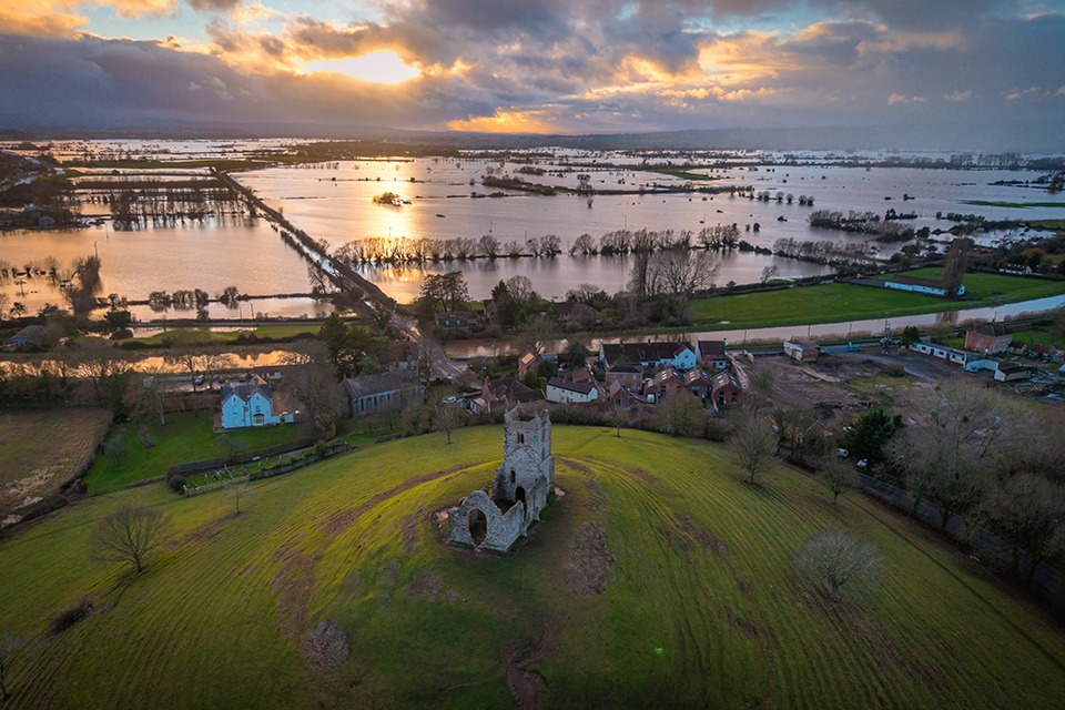
Flood deposits, reconstructed streets and medieval drainage systems tell a story more complicated than repeated natural disaster. A new archaeological synthesis shows how English communities lived with water, repaired flood damage and adapted their landscapes between 1200 and 1700.
Research: Katerina Velentza, Hannah Worthen and Briony McDonagh, Understanding the Archaeological Evidence of Flooding and Flood Risk Management for Medieval and Post-Medieval England. International Journal of Historical Archaeology, first published online 6 November 2026. Open access.
Recent years appear to have witnessed a series of devastating floods in much of present-day England (and Europe). This has led to a series of new studies exploring landscapes of flooding.
Flooding is among the most powerful forces to shape a settlement. A river brings trade, food, fertile meadowland and convenient communications; it may also undermine a house, destroy a wall or deposit half a metre of sand where a street once stood. Medieval English communities knew this double character of water. Their response was not simply to build a bank and hope for the best, nor always to abandon vulnerable sites. A new study by Katerina Velentza, Hannah Worthen and Briony McDonagh looks for the material evidence of those decisions in the archaeological record.
The authors examine England between approximately 1200 and 1700, covering later medieval and early modern centuries. Their purpose is not to reconstruct a complete chronology of exceptional storms. Instead, they ask what archaeologists can recognise when a flood has happened, how they can identify what people did afterwards, and which structures demonstrate the effort to control or accommodate water. The project brings together published scholarship, developer-funded excavation reports, Historic Environment Records, historical photographs and mapped landscape data. This gives the paper a particular strength: it recovers evidence that often lies scattered in reports written for quite different purposes.
Three kinds of evidence
The authors organise the material into three broad categories: the physical deposits left by storms and floods; the traces of repair, clearance and rebuilding that followed; and the infrastructure used to manage flooding. Keeping these categories separate is essential. A layer of silt may document inundation, but not necessarily how seriously people were affected. A raised floor may show a response to water, yet needs dating and stratigraphic context before it can be associated with a particular event. A drain might carry everyday wastewater, storm runoff or both.
Flood deposits are often especially elusive. In a town, people may remove the debris soon after an emergency. Later buildings can cut through earlier deposits. Different kinds of inundation also leave different sediments: slow inland flooding may deposit fine material, whereas a coastal surge can drive coarser sand and other marine deposits inland. Distinguishing those processes is part of the interpretative problem. The authors show how these clues survive in archaeological sequences, while insisting that they cannot invariably be matched to a named flood in a chronicle.
Storms that altered settlements
Among the cases discussed are places around the south and east coasts where medieval settlement was especially vulnerable. At Northeye in East Sussex, geoarchaeological evidence records changing sea levels and late thirteenth-century storm-related sedimentation affecting the embayments used for salt production. This forms part of the explanation for local decline and eventual abandonment. At New Romney in Kent, excavations revealed a substantial deposit of coarse sand, apparently associated with a severe thirteenth-century storm, and evidence that forceful water action damaged an existing structure.
These examples are valuable precisely because they connect natural processes to an inhabited and economically exploited landscape. A storm did not strike an abstract shoreline. It disturbed salt-production areas, property boundaries, buildings and the movement of goods. Yet the story should not be reduced to climatic determinism. The consequences of an event depended on the location of structures, the resources of inhabitants, previous management decisions and the possibility of repair.
Rebuilding rather than retreating
The paper also directs attention to actions taken after the water receded. Deposits of mixed rubble, domestic waste and reworked sediment can mark clearance of damaged sites. Elsewhere, inhabitants deliberately raised the level of a plot before rebuilding. The process changed the archaeological landscape itself: an elevated street or new building platform might represent not a natural accumulation but a decision taken in response to recurring inundation.
At Wisbech, layers associated with medieval flooding are interleaved with subsequent occupation and reconstruction. At King’s Lynn, made ground and levelling deposits demonstrate attempts to stabilise or raise vulnerable surfaces. The sequence of flood, clean-up, rebuilding and renewed occupation may be more revealing than any single catastrophic horizon. It shows communities calculating that the advantages of a town or trading location continued to outweigh the risks.
Other places were less fortunate. Some coastal settlement areas were lost or abandoned. The contrasting outcomes make it misleading to speak of a uniform medieval response. Adaptation might mean rebuilding a house on higher ground, repairing a wall, reclaiming a parcel of land, altering drainage or withdrawing altogether. The archaeological record can reveal these choices even when written testimony is thin.
Engineering water and allowing it room
Some of the most significant evidence consists of infrastructure. Banks and walls could keep out rivers or tidal water; lined channels, gutters, ditches, culverts and sluices could direct it elsewhere. Bridges might incorporate flood arches, either originally or as later additions to improve the passage of exceptional flows. Historic urban topography therefore needs to be understood in hydraulic as well as architectural terms.
The authors discuss the twelfth- or thirteenth-century Mere Bank at Bristol, river defences, waterfront revetments and the management of surface water in places such as Shrewsbury. Yet they also recognise a less defensive tradition. Flood meadows and low-lying fields might be left to receive seasonal water. Such inundation was not necessarily a disaster: floodwater could bring nutrients and sustain forms of agricultural use, provided that the timing and duration were manageable. The choice between exclusion and accommodation was therefore integral to the management of working landscapes.
This finding complicates the modern tendency to imagine historic water management solely as ever-higher embankments. Some medieval and post-medieval measures were designed to resist inundation, others to speed drainage, and still others effectively accepted that water had a place in the landscape. It is important not to romanticise the past—flooding could be destructive and unequal in its effects—but neither should we overlook the practical knowledge accumulated by inhabitants of wet places.
An archaeological archive for present concerns
The paper’s conclusion is deliberately forward-looking. Archaeological evidence could help contemporary flood management by showing where water has repeatedly entered settlements, which interventions were made and how previous responses changed the land. Modern flood-risk maps and long-term historical evidence may illuminate one another. This does not mean that a medieval drain provides a ready-made solution to twenty-first-century climate change. Conditions, populations and engineering capacities differ profoundly. It does mean that the past contains more locally specific information than records of disastrous dates alone can provide.
There is also a disciplinary challenge. Flood-related evidence may be hidden in excavation archives under inconsistent descriptions, or preserved in environmental samples whose significance was not initially recognised. The authors call for more systematic identification and documentation so that this material becomes usable beyond archaeology. Their study is thus both an environmental history of medieval England and a proposal for changing archaeological practice.
For the history of medieval landscapes, its enduring point is that settlements were not simply placed beside rivers, streams and watery meadows. They developed in continuing negotiation with them. Floodwater could create fertile meadows or obliterate a building; a repaired embankment could preserve a community or change the direction of the next inundation. Through deposits, repairs and earthworks, archaeologists can recover a history of choices once made in the presence of all sorts of water.
For the present time, the conclusion that one size never fitted all is worth remembering. Dealing with flooding was never just a question of raising the banks, widen the meadow or build some ditches. All sorts of solutions were brought to the table in the Middle Ages. Perhaps, this should also be the solution nowadays?
Karen Schousboe
ABOUT THE AUTHORS:
Katerina Velentza is a heritage professional, currently a Postdoctoral Research Associate in Environmental Humanities at the University of Hull. Katerina’s research focuses on the interrelationships between archaeology, heritage, climate change and sustainability.
Hannah Worthen is a Lecturer in Environmental Humanities who specializes in environmental and spatial histories and, in particular, the social history of early modern flood events.
Briony McDonagh is Professor of Environmental Humanities and UK national lead for the COAST-R Network Plus, funded by the UKRI and DEFRA under the Resilient Coastal Communities and Seas Programme.


