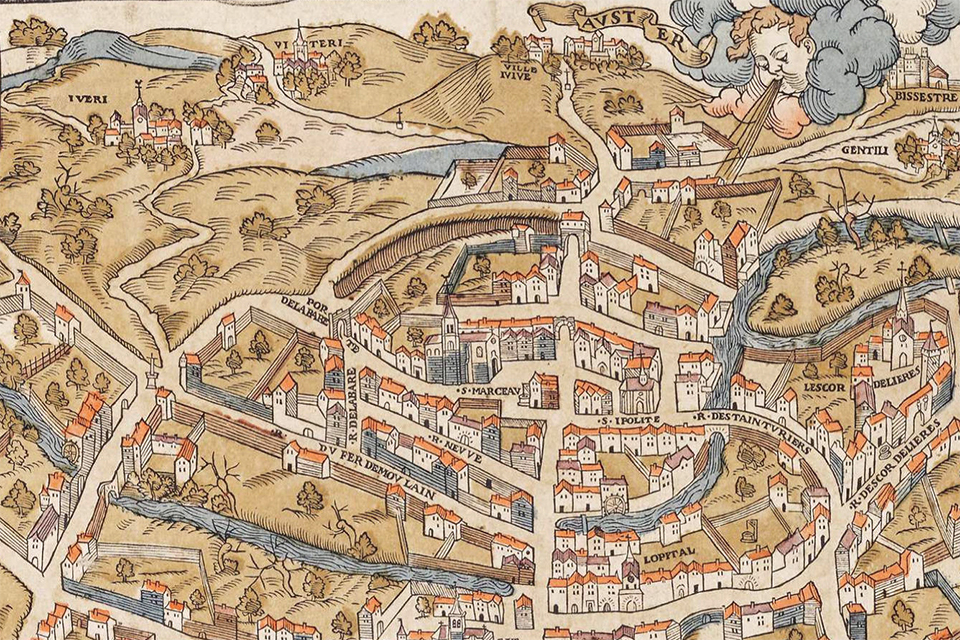
What was the physical world in which Parisians lived in the late Middle Ages? In a sense, Paris was still embedded in an ancient riverine landscape, despite being the only major metropolis in the region, perhaps numbering more than 200,000 inhabitants before the Black Death
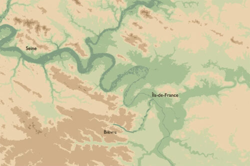
Long before Paris became a metropolis, the Seine carved its way through the great geological bowl of the Paris Basin. Across millions of years, successive seas deposited layers of chalk, limestone, marl, clay and sand, which were subsequently eroded into a landscape of rolling plateaux, shallow valleys and gently rising hills. Along the outer margins of the basin, the chalk formed pale escarpments, while closer to Paris, younger limestone formations shaped the higher ground and the river valleys cut through alternating layers of permeable and impermeable rock. Together, these geological formations created a landscape in which water was everywhere present, sometimes flowing freely, sometimes disappearing underground, only to emerge again as springs at the foot of the hills.
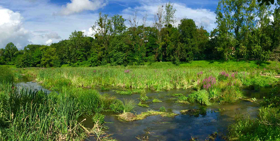
Through this broad, shallow bowl ran the Seine, gathering the waters of the Marne, Oise, Yonne and their numerous tributaries before continuing towards the sea. These rivers were not confined to the relatively orderly banks familiar today. Instead, their floodplains comprised a changing mosaic of channels, islands, sandbanks, backwaters and seasonally inundated meadows. Some channels gradually filled with silt, while others remained open or were reactivated by changing river conditions. Between them lay patches of marshland, reed beds, alder carr and wet meadows, where the boundaries between land and water shifted with the seasons.
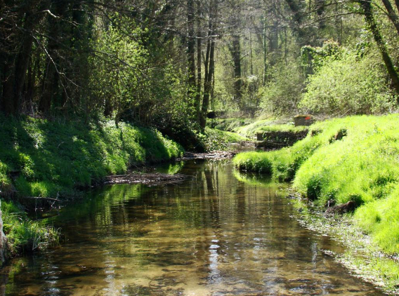
Along the smaller tributaries, the landscape could be even more intimate. Here, streams wound through narrow valleys where springs fed marshes and peatlands, and where willows and alders flourished in the waterlogged ground. On the better-drained slopes, oak, elm, hazel and other deciduous trees formed woodlands interspersed with clearings, grazing grounds and cultivated fields. Farther up, on the plateaux, the fertile loess soils offered favourable conditions for agriculture, although patches of woodland remained an important source of timber, fuel, pasture and other resources.
This was the natural setting in which medieval Paris developed. Yet it was by no means an untouched wilderness. Long before the Romans arrived, generations of farmers and herders had already cleared woodland, cultivated the slopes and exploited the river valleys to the west. Indeed, the history of the Paris Basin cannot be understood as a simple progression from forest to farmland. Rather, the landscape experienced repeated cycles of cultivation, abandonment, regeneration and renewed exploitation.
The Roman Optimum and the Early Middle Ages
During the relatively warm and stable conditions associated with the Roman Climate Optimum, agriculture flourished across substantial parts of northern Gaul. Fields expanded across the fertile plateaux, while villas, farms, roads and settlements formed an increasingly organised countryside. Woodland clearance and cultivation left their marks on the landscape, not least through the erosion of exposed soils, which were carried downhill and deposited as silt in the river valleys. Meanwhile, the rivers provided water, transport, fish and the power required for various activities. By late antiquity, the countryside surrounding Lutetia had already been shaped by many centuries of human occupation.
However, between the fourth and seventh centuries, this pattern began to change. The political and economic structures of Roman Gaul were transformed, while climatic conditions became more variable. The relatively favourable conditions of the Roman period eventually gave way to a period that included the pronounced cooling of the sixth century. Nevertheless, the environmental consequences were neither immediate nor uniform.
In some areas, cultivation contracted and woodland regenerated. Pollen evidence from the plateaux around Dourdan and Sénart suggests a substantial recovery of trees between the late fifth and seventh centuries, while reduced soil erosion in several smaller valleys points towards less intensive cultivation and perhaps a greater emphasis on pastoralism. Elsewhere, however, agricultural and pastoral activities continued. The banks of the Seine in Paris itself remained occupied and exploited, and the archaeological evidence from Quai Branly demonstrates that the river was already being managed during the Merovingian period.
Nor does the more recent evidence support the notion of a complete collapse of rural activity. A detailed investigation of the Mérantaise, a small tributary of the Yvette south-west of Paris, reveals a long history of agricultural and pastoral exploitation extending from the Iron Age through the Middle Ages. Although occupation at particular sites fluctuated, cereal cultivation continued to leave traces in the pollen record. From approximately AD 675, the sediments also reveal the retting of hemp in the valley’s waters. This activity demonstrates the exploitation of the stream for processing fibres, although it cannot in itself be taken as evidence of expanding settlement or intensified cereal production. Perhaps, the hemp was a cashcrop sold to shippers exploiting the commerce along the rivers and into the Channel? [1]
By the ninth and tenth centuries, therefore, the countryside surrounding Paris presented a varied picture. On some plateaux, woodland had returned to land previously cultivated. Elsewhere, fields and pastures remained in use, while farms, villages, churches and estates occupied the more favourable locations. Along the rivers, wet meadows, marshes and wooded banks continued to form a substantial part of the landscape. The environmental evidence from Quai Branly even suggests a local regeneration of woodland during the ninth and tenth centuries, although this should not be interpreted as a general retreat of agriculture throughout the region.
Paris in the High and Late Middle Ages
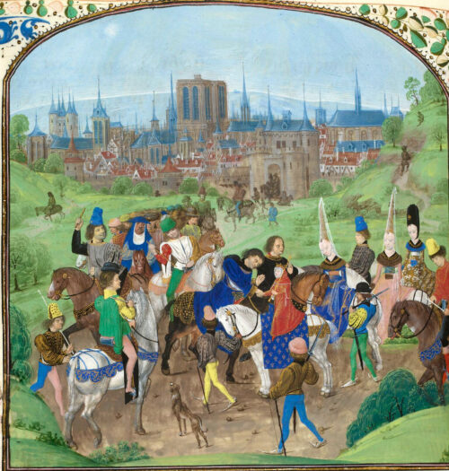
Around the millennium, however, the balance began to shift once more. Under the generally favourable conditions associated with the Medieval Climate Anomaly, cultivation and settlement expanded across much of northern France, although the pace and intensity varied considerably from one district to another. Woodland was cleared, existing fields were enlarged, and new settlements were established. Increasing agricultural activity also left its mark on the rivers, as soil erosion and sedimentation gradually intensified.
Yet perhaps the most remarkable transformation occurred in the watery landscapes of the valleys. Marshes and streams that had previously followed their own rhythms were increasingly subjected to deliberate management. Ditches drained wet ground, dams retained water, and millraces diverted streams to turn waterwheels. Meanwhile, artificial ponds were established for fish production, irrigation and the regulation of water supplies.
Religious institutions played an important role in these developments, particularly the Cistercians, whose monasteries were often founded near springs and marshy valley heads. However, they did not arrive in an untouched landscape, nor did they invent all the hydraulic technologies they employed. Many mills and watercourses had already been developed by secular landowners or earlier religious communities. Nevertheless, through their systematic organisation of ponds, drainage networks and mills, the Cistercians contributed to a wider transformation in which water became an increasingly managed resource.
As Paris grew, the demands placed upon its surrounding countryside intensified. Around 1200, the city may have contained some 60,000–80,000 inhabitants; a century later, estimates suggest approximately 250,000. Feeding such a population required an expanding network of agricultural production, transport and exchange. Grain, vegetables, fruit, wine, livestock, timber and other necessities flowed towards the capital, while the rivers and roads connected the city to an ever-widening hinterland [2]
The small rivers were no less important than the Seine itself. Their mills ground grain, their meadows supported livestock, and their waters served a variety of domestic and industrial purposes. As the historian Jean-Marc Moriceau famously observed, “Paris ate its nearby countryside”. Indeed, the growing metropolis increasingly depended upon the productive capacity of the whole surrounding region.
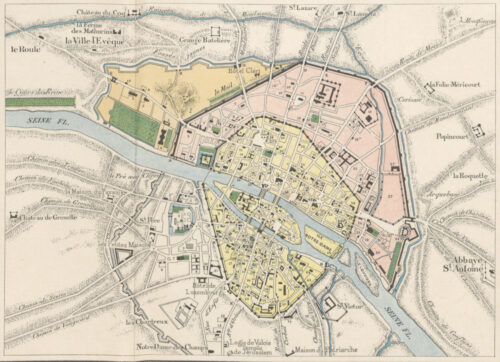
The calamities of the fourteenth century – poor harvests, warfare, epidemic disease and demographic contraction – interrupted this long expansion. Some settlements contracted or disappeared, while cultivation was abandoned in particular districts and woodland reclaimed former fields. By around 1450, the countryside was again undergoing change, although the consequences differed from place to place.
Thus, the landscape from which medieval Paris emerged was neither the wilderness imagined by later generations nor the familiar cultivated countryside of modern France. It was a living mosaic of water and land, shaped over centuries by climate, geology and human labour. Its rivers had always offered opportunities, but they also imposed limits. The extraordinary growth of Paris between the eleventh and fourteenth centuries depended in part upon the ability of its inhabitants and surrounding communities to negotiate those limits, transforming the watery landscape of the Seine Basin into one of the most productive and densely inhabited regions of medieval Europe.
Within this landscape, Paris developed into a vibrant centre of trade and commerce on the Right Bank, while the University and numerous religious institutions made the Left Bank a thriving centre of scholarship and religious life. The city’s development was further consolidated under Philip Augustus around 1200, when the royal government became increasingly centred on Paris and formidable new walls were constructed to protect the growing city. By the late Middle Ages, Paris had become one of the great metropolises of Europe, inhabited by a multitude of merchants, scholars, clerics, craftsmen and labourers.
Among them lived the Parisian burgher Nicolas Flamel, whose life, properties and pious foundations offer us an opportunity to explore the intricate social and religious world of medieval Paris.
NOTES:
1. Might the hemp have been grown as a commercial crop, perhaps transported along the rivers towards the Channel? This remains an interesting possibility. However, evidence of retting does not establish the scale of production or the destination of the fibres. See: Lucile de Milleville et al., “Three thousand years of anthropogenic impact and water management and its impact on the hydro-ecosystem of the Mérantaise river, Paris conurbation (France)”, Quaternary Science Reviews 307 (2023), 108066.
2. Population estimates for medieval Paris vary considerably. These figures should be understood as approximations rather than precise counts.
FEATURED PHOTO:
South west of Paris showing the Biévre running through the suburbs of Paris ca. 1550. Notice the regulated watercourse and the many mills. Source: Plan of Paris by Truschet et Hoyau. Detail from Wikipedia,
SOURCES
Christine Chaussé et al., Holocene history of the River Seine, Paris, France: bio-chronostratigraphic and geomorphological evidence from the Quai-Branly, The Holocene 18, no. 6 (2008).
Joséphine Rouillard, Paul Benoit and Raphaël Morera, L’eau dans les campagnes du bassin de la Seine avant l’ère industrielle. PIREN-Seine 2023
François Gentili, L’archéologie au village en Île-de-France : quelques exemples d’études diachroniques, Archéologie du Midi médiéval 36 (2018), pp. 81–101.
Jean-Charles Picard, Un monde rural : les campagnes de l’Est parisien du VIe au XIIe siècle, originally published in Histoire du Val-de-Marne (1987), pp. 39–54; reprinted in Évêques, saints et cités en Italie et en Gaule (1998), pp. 425–438.
READ MORE:
 Landscapes and Landforms of France (World Geomorphological Landscapes)
by Monique Fort (Editor), Marie-Françoise André (Editor)
Springer Verlag 2013