What role did the Early Medieval climate changes ca. 400 – 700 play in the creation of the post-Roman world? Did people migrate because of the cooling weather? Detailed study of Western Pomerania sheds new light
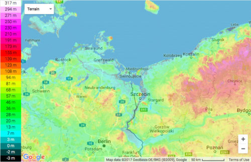
The River Oder, which rises in the Czech Republic, runs for a long stretch along the present-day border between Germany and Poland. Just after Frankfurt an der Oder, the river Warta, which rises in the south eastern corner of Poland, starts to feed it. After running another 100 km, it flows into the Szczecin Lagoon before ending up as an atypical delta.
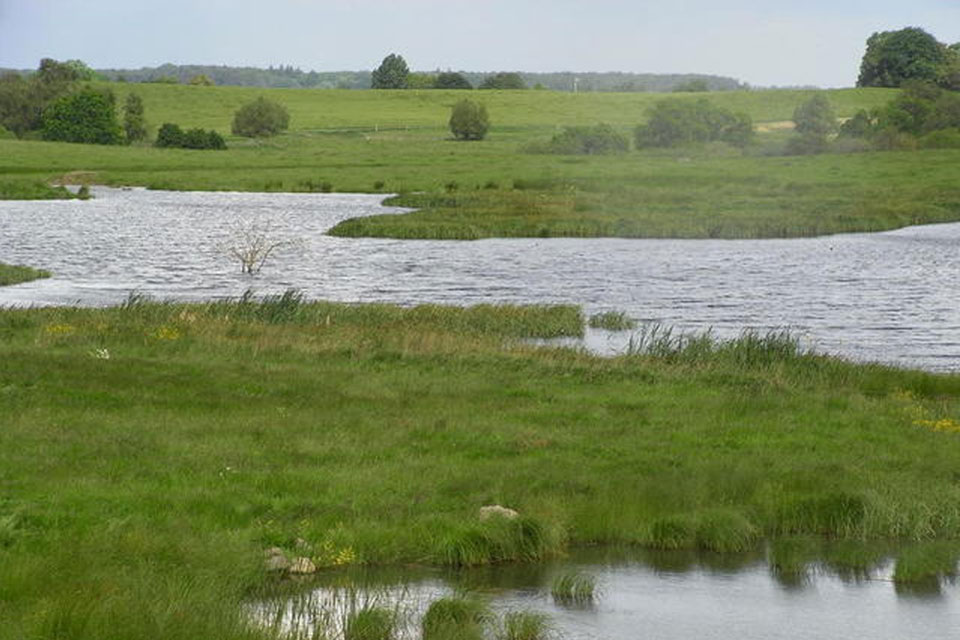
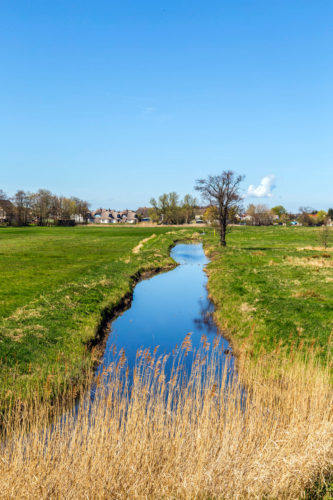
This landscape, the result of a glacial transformation, is usually subdivided into five zones. Along the coast is a zone characterised by wetlands built up of silt, peat, sand, and grain. Behind, we find an outwash plain (sandur), which further inland gets mixed with clay and gravel. Further inland lies a terminal belt of moraine. To the northeast, we find islands or strips of black earth or Chernozem. As the landscape shifts from the hinterland and out to the sea, it also changes down to the riverbanks. The landscape is moderately to strongly influenced by backup water and moderately by groundwater.
The topography is flat to rolling and sometimes hummocky. Along the many rivers and streams can be found deep lowland moors as well as moraine islands. Today, the landscape is universally drained and intensively used for agriculture. However, it still presents itself as a flat, rolling, and humid plain crisscrossed by streams, ditches, and occasional backwater. In general, the landscape must be characterised as much less fertile than that which lies to the west close to the river Elbe.
The landscape belongs administratively to the old Western Pomerania, now split between Germany and Poland. In the Early and High Middle Ages, predominantly free peasants worked the land. Later, after the Thirty Years’ War, it was turned into a region characterised by large manorial estates worked by serfs living under harsh conditions.
Early Medieval Northern Pomerania
This region has been studied in detail by the archaeologist, Armin Volkmann, who has carried out extensive surveys of the shifting patterns of settlements from c. 700 BC to 800 CE, with a particular focus on the patterns of settlement in the Migration Period, 4th–7th centuries.
The method used has been to systematically map traces of settlements, graves, and hoards by trawling through the published literature and unpublished reports, etc. The registered and dated shifts in population density were afterwards paired with the climatic shifts as registered by studies of dendrochronological proxies.
Volkmann’s studies have documented that profound changes took place in the region from c. 400 BC to 800 CE.
At first, c. 700–80 BC, an average population density was registered. However, around 80 BC–20 CE, the density fell markedly. Soon after, though, it recuperated with a population whose graves showed a growing number of Roman luxury artefacts. Armin Volkmann deduces that the relative decline in the population density at this time was caused by the migration of men joining the Roman army as foederati, or just plainly trying out their luck along the Limes. After serving, they would have returned furnishing their graves with the spoils of war. At this point, the pull factor was probably the primary explanation, as the weather (the Roman Optimum) was warm and advantageous for the mixed farming of the period.
In the next 160 years (20–180 CE), the population density seems to have risen remarkably, basically quadrupling. At this point, however, a slow, gradual migration began once more. At first, the pull factor of the vibrant frontier economy along the Limes must have been the principal inducement. Perhaps slightly levelling out c. 280–380 CE, the migratory movement now sped up. Perhaps within a few decades after c. 400, the population density fell by 80–90% compared to its former optimum around 150–200 CE.
This new and very low density – 10–20% of its former level – continued to characterise the region until ca. CE 700 CE, when growth gradually took off again. However, it was not until ca. 1230 CE that population density reached the former level in the Late Roman Iron Age. Only a few settlements were registered along the coast, where people obviously had the opportunity to partake in the Baltic trade.
What happened? In Armin Volkmann’s opinion, the timing of this downturn fits well with the cooler and at first drier weather, which set in around 400; a truly inhospitable landscape. The date is significant because it fits well with the fact that other migratory movements in Europe took off at this point.
Volkmann, though, is of the opinion that we should not see the evidence as an affirmation of a large-scale migration event. Rather, the evidence points to a slow but gradual depopulation caused by a combination of pull and push factors. Volkmann argues that contingents of people in all likelihood were drawn to the Limes to enter the army as foederati or as workers on the fortifications on the frontier. Later, after ca. AD 450, they became mercenaries in the armies of the barbarian successor kingdoms.
At first, people moved westwards. Around AD 500, they turned south and east towards Pannonia, where they may have joined up with the Goths.
The evidence indicates that at this point the migration was not just carried out by a few high-status warriors, who with their warbands were seeking a better life. Rather, the study demonstrates that the migration now involved a movement of massive numbers of people. However, when the climate further deteriorated after AD 536-42, the result was a vast and empty space. Only a few settlements remained along the coast of the Baltic, where people seem to have been engaged in trade with the Scandinavians as well as farming the narrow strips of black soil.
Volkmann speculates that a major factor – apart from the deterioration of the climate – might have been the gradual erosion of not just the available workforce, but also competences and knowledge about how to live in the rather inhospitable landscape increasingly characterised by shrubs, reforestation, and a combination of desertification and inundation. However, the pull factor of the vast possibilities of plunder and resettlement in the less harsh south after the Roman implosion will also have acted as a significant inducement.
It seems that until the beginning of the 8th century and the so-called “Slavic Migration,” the region remained a vast unpopulated and “wild” landscape.
After completing and publishing this research, Armin Volkmann is currently working on carrying out a comparative analysis of the “Unter Franken” to study how the same events played out near the Limes.

Sources:
Siedlung — Klima — Migrationen. Geoarchäologische Forschungen zum Oderraum zwischen 700 vor und 1000 nach Chr. mit Schwerpunkt auf der Völkerwanderungszeit.
By Armin Volkmann
Series: Studien zur Archäologie Europas Band 18.
Verlag Dr. Rudolf Habelt, Bonn 2013
Region im Wandel: Das 5.–6. Jahrhundert n. Chr. Im inneren Barbaricum and der unteren Oder und Warthe.
By Armin Volkmann.
In: Germania. Anzeiger der Römish-germanischen Kommission des deytschen archäologischen Instituts. (2014), Vol 92, no. 1, pp. 133 -154.
Climate Change, Environment and migration: a GIS-based study of the Roman Iron Age to the Early Middle Ages in the River Oder Region.
By Armin Volkmann.
In: Post-Classical Archaeologies (2015).
READ MORE:
Digitalbasierte Forschungen der Archäologie – Archäologiedigitale Blog