New studies of the well-organised use of the fluid landscape in the Early Medieval Fenlands point to a continuity in the settlement-structure from pre-Roman times.
“…a most dismal fen of immense size…consisting of marshes, now of bogs, sometimes of black waters overhung by fog, sometimes studded with wooded islands and traversed by the windings of tortuous streams,”
From: Felix’s life of Saint Guthlac. Trans. Bertram Colgrave. Cambridge University Press 1956, ch. 24
The Early Medieval Fenlands represents a rich puzzle for archaeologists and historians. Until recently it was thought that the landscape was nearly devoid of people, when the Angles and Saxons arrived. Further, it was believed that when these migrants did arrive, they entered through the Wash; and finally that they significantly transformed the material culture and life-form of the few remaining Britons, who did not flee out west.
Now it appears new studies of the landscape offer a somewhat different interpretation. In fact, the Fen islands and the silted fens show a degree of late Romano-British occupation, which was unexpected only a few decades ago. Thus, there is no reason to believe that the fens were as empty and dismal as Felix writes in his vita of Guthlac in the beginning of the 8th century; on the contrary!
“Dense Romano-British settlement appears to have been followed by consistent early medieval occupation on every island in the peat fens and across the silt fens, despite the impact of climatic change” writes Susan Oosthuizen in the blurb of a new book expected to be published in January 2017, titled “The Anglo-Saxon Fenlands.”
This will without doubt be an important book, following in the footsteps of Darby and Thirsk, who wrote respectively of medieval and early modern patterns of exploitation of this fluid and complex landscape. As is obvious from the title, however, Oosthuizen is reaching further back in time in order to outline the conditions of life in the marshes, when the people from the continent arrived in the beginning of the 5th century and began to take over.
How did they organise themselves? What kind of landscape did they arrive in? What impact did they have on the ways of life in the Fenlands? Did they bring with them new forms of settlement? New ways of life?
Of course, we will not know until the book is shipped from the printer. However, quite recently an overview of “Culture and Identity in the Early Medieval Fenland” written by Susan Oosthuizen was published in Landscape History; it is obvious that some of her explorations and arguments have been tried out here and we are thus allowed a peep inside the covers.
The Fens
As so often described the Fens is a vast delta through which the rivers from the Midlands are drained into the Wash and further into the North Sea. As such it is divided into three different types of landscape: to the south are the peaty wetlands, fed by rain and rivers, to the north the vast delta of silts and on the coast a fringe of salt marshes fed by tidal flooding. In the peat-land we find meres and lakes as well as constantly shifting rivers and tributaries pushing their way through wherever possible. In this landscape living habitats could be found on the edge of the fens as well as on islands of higher ground. However, settlements in the silt were also possible, building terps like those discovered at Pinchbek, Gosberton and Quadring.
The Settlements
 Reviewing the latest archaeology, Oosthuizen is able to demonstrate that Anglo-Saxon activity was widespread already in the Early and Middle Anglo-Saxon periods (AD 400 – AD 850). During this period settlements could be identified not only on the edge of the Fens, but also on the islands and in the silt itself. “There was ‘extensive’ early medieval occupation, despite the impact of climatic change”, writes Oosthuizen and continues with describing the political organisation in the later 7th century fens.
Was the region an anarchic wilderness as implied by the vita of St. Guthlac or was it in fact a highly organised landscape primed for intensive use of the divers available resources? she asks.
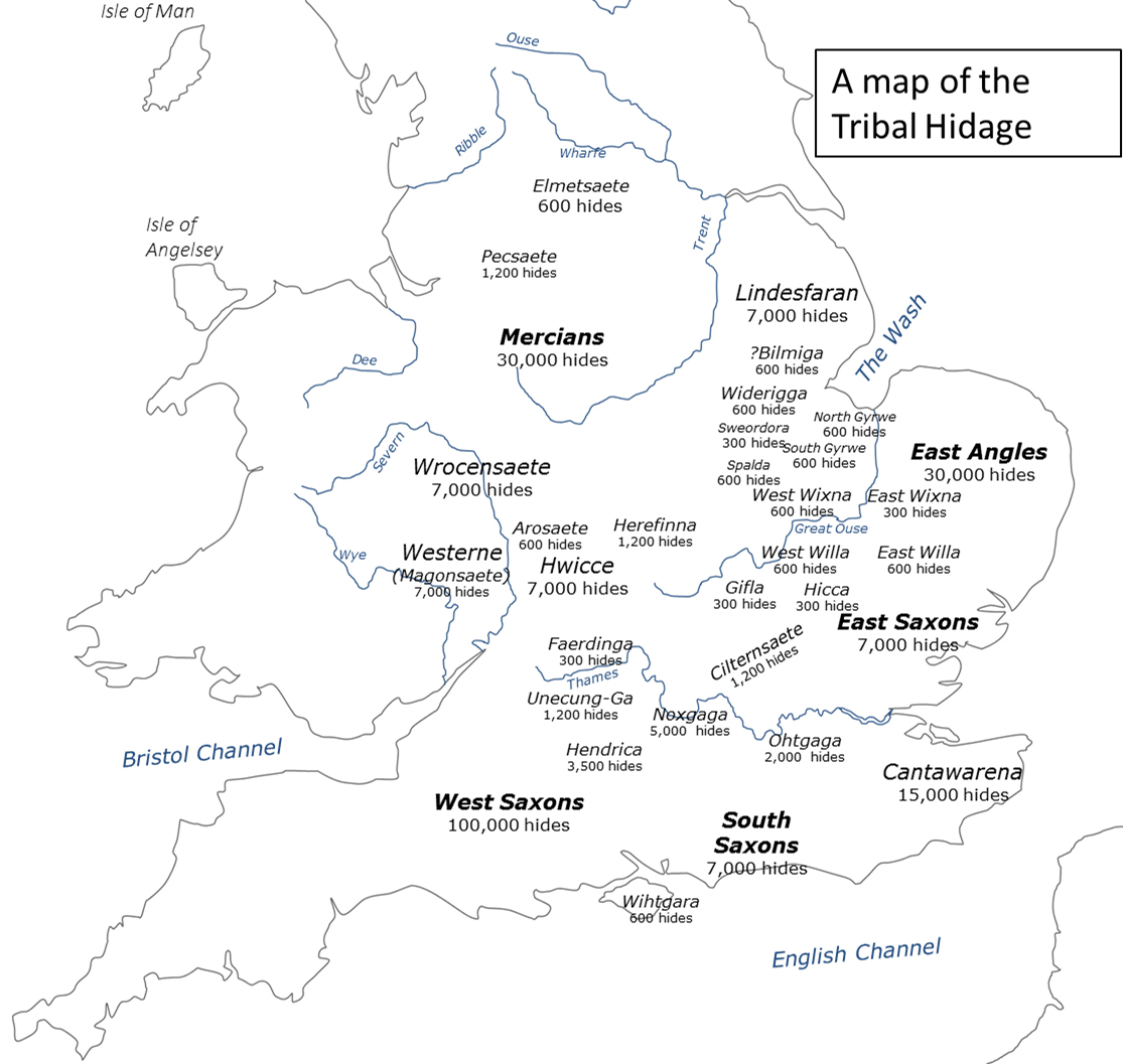
To answer this question, we are invited to a detailed exploration of the Tribal Hidage, a unique document outlining the tributary possibilities of different kingdoms and minor political units in 7th century East Anglia. The fascinating thing is that this document – apart from outlining a number of larger kingdoms – especially lists smaller political units located along the border of the fen basin – each numbering 600 hides (except Sweodora, which only lists 300). Whatever the reality behind these numbers and the exact boundaries of the polities, the fact remains that the region along the great Ouse and reaching into the Fens constituted a landscape divided into very small political units at a time when the neighbours, the Mercians and the East Angles could each muster 30.000 (fifty times as much).
Oosthuizen further argues that “the territorial extent of these early political units in the fenlands might be preserved in the organisational system governing medieval rights of common and intercommons”; these were governed not by manors but by exclusive groups of farmsteads (vills). It appears that whoever owned or controlled these vills, simply had equal access to their part of the commons or intercommons, a right which was legally enforceable. If this is correct, it indicates there existed a considerable degree of political stability in the manner in which the commons were utilised from the early Anglo-Saxon period and into the Middle Ages.
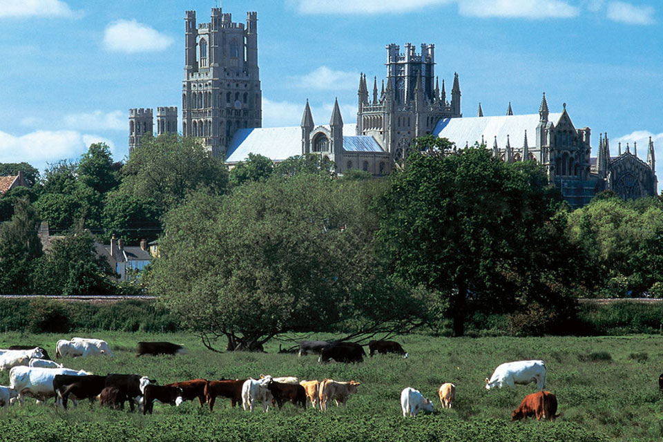
More particularly, she explores the evidence in the so-called Ely Coucher Book, which carefully delineates the grazing and other rights of the four hundreds, the island of Ely was divided into. Each hundred thus had their own carefully delineated district of valuable water-meadows, except that the Abbey itself had similar rights inside all the four catchment areas. However, this might easily be explained by the fact that Ely probably was the caput regia of a sub-polity belonging to the kingdom of East Anglia (read the article for the full argument).
This was obviously not a region where people lived precarious lives on marginal land; rather, their prosperous livelihoods rested on the deft exploitation of a diverse set of resources among which vast grazing rights obviously played a role. However, we can probably deduce that a whole lot of different resources were exploited; fishing, trapping eels, fowling, harvesting sedge and reed and digging peat would all contribute to the wealth; and were perhaps shared on equal basis.
The Cultural Identity
But who were these people? What language(s) did they speak? What cultural and political identities can we detect? Or more precisely: did they in some way consider themselves as set apart: as “Anglo-Saxons”?
These questions are not easy to answer, but Susan Oosthuizen makes a heroic effort to explore the possibilities in a micro-historical perspective. This pays off.
First of all, she mentions the curious fact that the region never yielded particularly many place-names of Old English origin. In fact, only thirteen names have been identified, of which no more than ten can be securely pointed out. Nevertheless, of those, which can be securely identified, a number refer to particular clans, such as Islington construed of ‘Elesa’ (personal name) with the suffix – ingas, meaning ‘small clan’ and combined with ‘tun’ (small estate); thus Islington was originally the small estate, inhabited by Elesa and his clan. Uniquely, a map of these names show that they were either located on the islands in the peat or in the silt. However, these names were mixed with ten locations holding British (Brittonic) names (six definite). To this must be added five (two secure) place names which ends on – wealh, indicating that here lived – according to the Old English speakers – the British-speaking people. 46% of the named locations were thus in Old-English, while 36 % retained their British name; an additional 10% were named by Anglo-Saxons but specifically identified as places where British-speaking people lived.
In conclusion, we are told, the place names confirm, that although Old English was spoken across the Fenland, British was as well. Which means that the parallel adoption of the new material culture (which is well-known) perhaps did not so much reflect a major influx of people, but rather a process of cultural mixing and acculturation. But Oosthuizen also writes in her abstract to the article that as of now, “the influence of migration on the evolution of early medieval Fenland culture remains enigmatic”.
Conclusion
This is of course, where the article leaves us panting for the book, which will be published in January 2017. The question is, how will it deal with all the new evidence, which continues to be piled up indicating that a major migration must have taken place. The latest of these instalments was published in Nature in January 2016 arguing that “on average the contemporary East English Population derives 38% of its ancestry from Anglo-Saxon migrations”. This evaluation is based on a comparison between ancient DNA of material from AD 450 – 850 and modern DNA profiles.
On the other hand, these new studies of Ancient DNA also shows that the material cultural profile of the studied individuals does not fit with their genetic profile. In fact, they show that mixing of both blood and cultures took place until the cultural and political abyss widened in the beginning of the 8th century.
Curiously enough this new research deals with DNA extracted from a burial-ground in Oakington on the edge of the Fenlands!
Wonder, what she will think about that!
SOURCE:
Culture and Identity in the Early Medieval Fenland”
By Susan Oosthuizen
In: Landscape History (2016) vol 37, no. 1, pp. 5-24
READ ALSO:
Recognising and moving on from a failed paradigm: The case of agricultural landscapes in Anglo-Saxon England c. 400-800 (review Article)
In: Journal of Archaeological Research, June 2016, Vol. 24, No. 2, pp. 179–227
ABOUT THE AUTHOR:
Susan Oosthuizen is reader in Medieval Archaeology and Academic Director for Historic Environment (landscapes and gardens) at Cambridge University. She is a Fellow of the Society of Antiquaries of London, a Fellow of the Royal Historical Society, a Fellow of Wolfson College, Cambridge, and a former President of the Cambridge Antiquarian Society. She delivered the 2012 Hoskins Lecture on ‘Medieval Open Fields and Their Origins’.
FEATURED PHOTO:
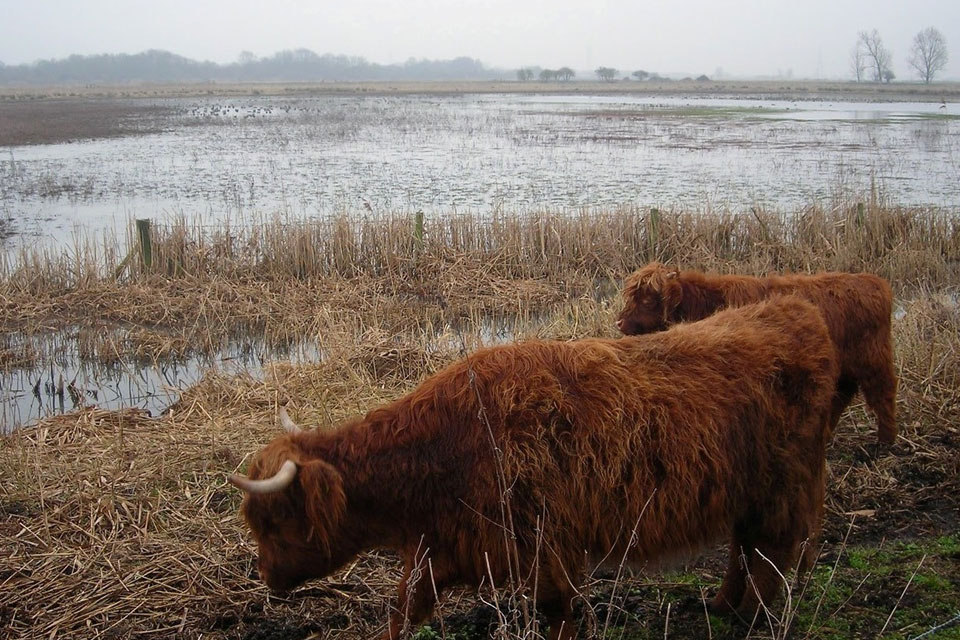
Higleand Cattle grazing in the Wicken Fen © Wicken Fen