The Ebstorf Map belongs to a group of maps known as the Mappae Mundi
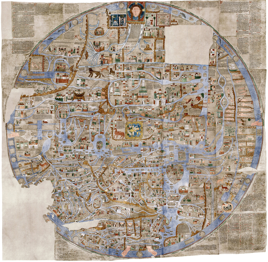
The Ebstorf Map from the 13th century is the largest medieval map known . Although the original was lost during WW2 it is well documented by photos, lithographs and facsimiles. In 1951 -1953 three reproductions were created, one of which may be seen at the convent at Ebstorf, where the map was discovered in 1830.
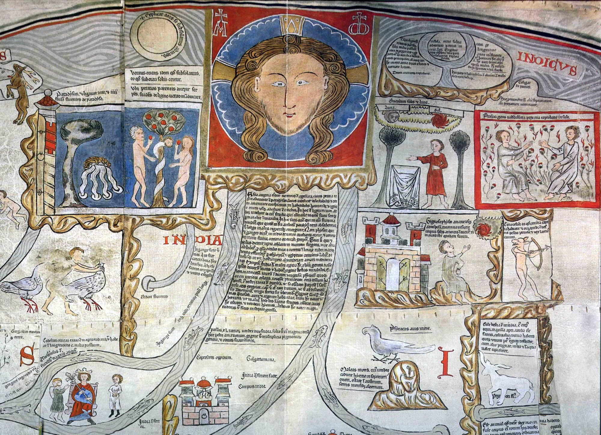
The original map consisted of 30 single pieces of goat-skin, sewn together, measuring 3.5 x 3.5 metres, and rolled up. Although the map is part of the genre called “Mappa Mundi” (idealised representations of the known world) it differs by its sheer size and its compactness of information.
According to new research carried out by the Historian Gudrun Pischke it holds 2345 entries – 1500 pieces of texts, 845 pictures showing buildings (500), rivers lakes, seas and other waterways, islands (60), people (45) and animals (60). To this should be added numerous religious motifs.
Like all Mappae Mundi the map is oriented towards the east. The earth itself forms the body of Christ, as witnessed by his feat dangling below. In the centre we find a gold-framed presentation of the resurrection, located smack in the middle of Jerusalem.
The map is best seen as a visual encyclopaedia of the knowledge of the world ca. 1250. It covers theology, geography, biology, secular history and the history of salvation as well as myths and bestiaries.
As with other mappae mundi it is intensively debated what they were for. Were the maps meant to be objects of devotion, decoration, meditation, education? Neither is there in any sense agreement as to who might have made the map, although some believe the person responsible for the map was Gervase of Ebstorf, prior at Ebstorf from 1222 – 1234, alias the lawyer, courtier and author Gervase of Tilbury, ca. 1150 – ca. 1228.
However, this identification rests primarily on the fact that Gervase is an uncommon name in Germany, the fact that his opus magnum – the Otia Imperialia: Recreation for an Emperor – reflects the same mixture of eclectic knowledge as the map, plus the fact that the monastery in Ebstorf, where the map was found, belonged to the premonstratensians, with whom Gervase of Tilbury is believed to have spent his last days as a canon.
Finally scientific analysis of eight different hands of scribes represented in the map and identified as active in the archive at Ebstorf has enabled a dating of the map to ca. 1300.
SOURCE:
The Ebstorf Map: tradition and contents of a medieval picture of the world
By G. Pischke
In: History of Geo- and Space Sciences, 2014, Vol. 5, No. 2, pp. 149 – 154. (Open Access)
SEE MORE:
A high-resolution presentation with detailed commentary can be found at Die Ebstorfer Weltkarte. Here some of the pictures are identified by pop-ups while translation (into German) of the many texts is offered.
READ MORE:
Die Ebstorfer Weltkarte: Kommentierte neuausgabe in zwei Bänden. Band I: Atlas. Band II: Untersuchungen und Kommentar
By Hartmut Kugler, Sonja Glauch, Antje Willing and Thomas Zapf.
Oldenbourg Akademieverlag 2006
Language: German
ISBN-10: 305004117X
ISBN-13: 978-3050041179
VISIT: