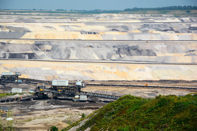
Between Jülich and Düren in the Northern Rhineland lies a bleak landscape, now scarred by lignite mining. Beneath lies a precious time warp of a medieval landscape
 Germany is (in)famous for its mining of lignite, also called brown coal. With a high content of moisture and emission of carbon dioxide (double of natural gas), it is known as one of the worst alternatives to sustainable energy on the world market. Heavily mined in the first part of the 20th century, it was an important source of energy before and during WW2; as it is today! Continued exploitation necessitated as late as in 2011 the resettlement of several hundred inhabitants in a small village, Pier, whose ancestors had lived in the region – it appears – since before Roman times.
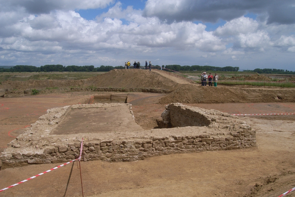
One advantage of these open pits is, however, the archaeological possibilities they offer to survey large tracts of land without hindrance from existing buildings. The recent expropriation thus created a unique opportunity of studying a rural landscape and its changing social structures over several millennia. Since 2011, the so-called “Pier-Project” has been focusing on excavating and surveying an area larger than 70 ha. Recently, Timo Bremer published an overview in English of some of the results from this ongoing project. [1]
Medieval Landscape
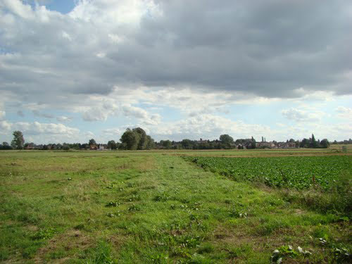
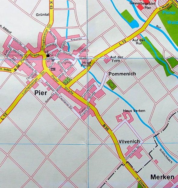
Pier was the name of a village in Inden, located on the loess plateau rising above the flooded plain along the river Roer to the east. Obviously, this was an attractive location. With ample access on one side to the flooded meadows along the river and with abundant forests along the rivers, the site offered attractive opportunities for farming.
The early towns surrounding Pier – Aachen to the south-west, Jülich to the north, Cologne to the east, and Düren to the south – witness to the importance of the region. A fertile area with rivers and meadows it was densely populated between the 1st and the 4th centuries. With a production concentrated on the villas, it served as an important agrarian hinterland for the Roman fortifications along the Limes. It is likely that Pier itself was characterised as a vicus. Spoliae of a temple have been found dispersed in the surrounding settlements. During the next 2000 years – until the last inhabitants were resettled in the 21st century, it continued to exhibit this “central” character.
Merovingian times
From 450 – 700 CE the main finds stem from three cemeteries: one, the earliest from the 5th and early 6th centuries was located 50 metres west of the later church. From the 6th to the 8th centuries there were two additional cemeteries, writes Bremer. One was located beneath the church while another could be found 190 metres to the west. A few separate burials indicate that people were also occasionally buried on their farms.
The earliest church in Pier, from the 7th century, was probably a wooden construction. It is highly likely that this was at the centre of a magnate’s private residence. Later it was mentioned in a charter from 873 in which the Abbess Regenberga reserved half of the tithe owed to the church for herself. At this time, the local community was characterised by a regional population density: of 4.42 – 6.54 individuals per km2 for the wider region (not including cities). Dense compared to that of the neighbouring parts of Saxony, but only half to a third of what it had been during the Roman Optimum, it served to demonstrate the importance of the region. [2]
High Middle Ages
Archaeological surveys did not provide a detailed overview of the exploitation of the landscape in Merovingian times. However, from the 11th to 14th centuries an excellent sense of the place can be obtained; also, it is possible to gain some insight into how it changed during this period.
At the centre, according to Timo Bremen, there was a core-zone around the church, which held three wells likely furnishing the whole village with communal water. This core did not seem to have been densely populated, but the exact structure is not quite clear. Opposed to this was the district in the periphery to the north-east, which was densely populated. Here people lived in sunken huts, often with kilns next to their houses, but no wells. People here probably lived as workmen, metal craftsmen (iron extraction) and perhaps small-time pedlars. Finds also indicate there was a textile industry (flax).
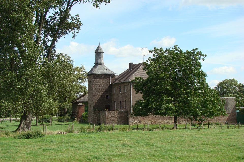
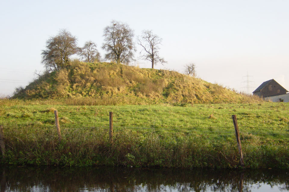
To the west of the church was a moated plot with a possible representative building in the centre; this was likely a motte construction. Further out to the south were two other such houses built of woods or stones, one of which was moated. Between the centre and the moated “House Pesch” – and to the north – several other settlements each consisting of two to four rectangular plots were located, each plot separated by straight paths. The buildings (potholes) on these plots indicate they home to ordinary farms. One of these settlements was located in the floodplain and probably took most of the income from extensive cattle farming.
Special interest accrued to the two noble residences off the core settlement. One, Haus Pesch, was mentioned for the first time in 922. It was nearly totally destroyed during WW2 (as was the whole area). Rebuilt stone upon stone after the war, it was torn down in 2013. Archaeological excavations showed that the place had been moated. In the later Middle Ages, the wooden house had been torn down and replaced by a more representative stone building. From the charter from 922, it appears the house may originally have functioned as a hunting lodge belonging to the Archbishop of Cologne. Later, its land was parcelled out under the name of Bonsdorf. But Bonsdorf is a toponym of Frankish date (the “dorph” or “torp” of Bonis)? It is likely there was a settlement there in Merovingian times out of which later grew the noble “House Pesch” (Pfesch meaning forest-meadow).
History of the People
It is evident, writes Timo Brennen, that the early elite focused on the settlement core near the later church. Here the remains of a Roman temple were found as well as the cemetery with the most prestigious Merovingian graves. On top of these, the first church was built, which was in all likelihood part of a magnate’s residence. Later in the 10th century, however, the lower nobility or local gentry moved out of the centre and built solitary and defensible residences on the outskirts. These new elite residences were obviously intended as symbolic statements about the nobility of their residents. Their references were the new and very impressive castles, which the landscape became increasingly dotted with in the 11th and 12th centuries.
To which extent the gentry continued to be in control of the local neighbourhood, which in the same period experienced significant growth as witnessed by the new residential area filled with workers and craftsmen, and the new settlements with farms surrounding the the village, is an open question. It is likely that the larger farms, which were built in the periphery of the nucleus, as well as the people living in the core of the village came to house peasants who established themselves as a “rural elite”. Without moats around their residences, however, they were clearly distinguishable from the “moated” gentry. Exactly who owned the land on which the workmen and craftsmen had squatted is nevertheless another question. Were they controlled by the local gentry? Or the rural elite living on the new farms? Timo Bremer is of the opinion that it was the rural elite, who was in charge of the “new” village. Chances are, though, that power might shift back and forth according to who were able from time to time to rise above the landscape. Social membranes may very well have been porous and shifting.
Jülich and Düren
In the charter from 922, we hear about Pier as located in “pago Juliacensi”. Obviously, Pier and surroundings belonged to the wider sphere of Jülich, located 10 km north along the river Roer.
Jülich is first mentioned as Juliacum located on a major Roman road linking Cologne with Aachen and Maastricht. In the 4th century, it was fortified. Later, in the 5th century, it was taken over by the Merovingians. Out of this, a distinct district was forged, which was ruled by a count; in the later Middle Ages, it was turned into the Duchy of Jülich. The first count mentioned in the sources was Gottfried (905 – 947). Heavily bombarded during WW2 the town now lay in ruins. A single monument from the high middle ages was fortunately preserved, the Altenburg.
Sometime in the 11th century, this fortified site was constructed south of Jülich with a motte and bailiff. Two to three km northeast and across the river Roer from Pier, it is believed to have been part of a network of fortifications erected by the counts of Jülich. Altenburg plus others were intended as a line of defence against the attacks repeatedly instigated by the Archbishop of Cologne (who had interests in controlling not only the area but also the road between Cologne and Aachen.) This Altenburg was obviously a much larger fortification than House Pesch in Pier, which was comparably a small and only symbolically fortified place. Doubly moated and fortified with palisades, Altenburg measured 85 metres in diameter, while the baily measured 20 x 50 metres and was fitted with stone towers and possibly a stone wall.
To the south of Pier is Düren. Known from Roman time as Durum, Caesar conquered the place, and Durum soon became part of the supply area for Cologne. Later, the Franks led by Clovis passed through on their way to Zülpich to conquer the Thuringians. It is probably a reflection of this that we can read in the Frankish annals how the Carolingians possessed a royal palace there, Villa Duria (first mentioned in 747), which has been archaeologically located beneath the present church of St. Anna. Here, a Carolingian church was erected around 700, and in the years 761, 775 and 779 royal Frankish assemblies were held there; also Charlemagne used the villa as a stop-over when travelling from Aachen to Frankfurt. For a long time, this road was called the “Krönungsstrasse” or the “Aachen-Frankfurter Heerstrasse”.
Autoroute A4
Today, the autoroute A4 runs south of Jülich and north of Düren. With the bleak mining districts to the north, tourists on their way to Aachen pass along the last part of this ancient road, just four km south of Pier, when travelling from Cologne. It is not too much to claim that this is one of the central neural pathways of Europe.
As such, history tells us that it has been the scene of endless destruction. Beginning with Caesar in 53 BCE, it was later the march route of Clovis, who fought his way to conquer the Thuringians at Zülpich in 496 CE. Later, it was the scene of numerous armies marching back and forth with occasional chevauchées reported in the sources. During the religious wars in the 16th and 17th centuries the landscape was ravaged until finally plague hit. Following the Napoleonic wars, the region became once again part of Germany, this time under the orbit of Prussia. It is during the 19th-century, massive industrialisation once again secured the region wealth and prosperity. In 1944 and 1945, however, this ended with numerous bombings followed by the allied army fighting its way through this ancient corridor towards the Rhine. In November 1944 Düren was totally smashed with 99.2% destruction. Jülich to the other side suffered a destruction of 97.6%. In between, Pier and surroundings were also hit. Finally, after having been rebuilt by hand in the 50s, it nevertheless suffered a final defeat at the sticks of the excavators.
Left is only a fascinating archaeological story!
Karen Schousboe
Footnotes:
[1] Timo Bremer is archaeologist (PhD) and currently holds aposition as senior research assistant at the University of Bonn. His research interest focus on landscape archaeology, rural space and settlements.
[2] Untersuchungen zur Bevölkerungsdichte der vorrömischen Eisenzeit, der Merowingerzeit und der sp¨ten vorindustrielle Neuzeit and Mittel- und Niederrhein.
By Karl Peter Wendt, Johanna Hilpert und Andreas Zimmermann et al. In: Bericht der Römisch-Germanischen Kommission, Bd. 91, 2010. Philipp von Zabern 2012, pp. 288 – 289.
SOURCES:
Von der Spätantike zum Hohen Mittealter. Lanscahftsarchäologische Untersuchunge im raum Inden-Pier.
Presentation of project at the University of Bonn

Stiftung Archäologie im Rheinischen Braunkohlrevier
Landscape, Power and Settlement Dynamics. Notes on Archaeological Methods by means of Examples from Northern Rhineland, Germany.
By Timo Bremer
In: Cracow Landscape Monographs Vol 2. , pp. 69 – 79
The Social Structures of High Medieval Rural Settlements
By Timo Bremer
In: The Farm as a Social Arena. Ed. by Liv Helga Dommasnes, Doris Gutsmiedl-Schümann and Alf Tore Hommedal. Waxmann 2016, pp. 273 – 296.
FEATURED PHOTO:
Haus Venker, one of the medieval fortified manors near Pier. Photo: Udo Geilenbrügge. Source: Stiftung Archäologie im Rheinischen Braunkohlrevier.