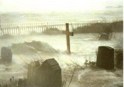
Huge storms and devastating floods are not something new. Medieval history shows that human overexploitation and not the climate may be behind many tragedies

Medieval history shows that human overexploitation and not the climate may be behind many tragedies caused by floodings and storms
At the start of the Little Ice Age, the North Sea was hit by a series of storms. Likely caused by a toxic mixture of waning solar activity, volcanic forcing, and shifts in the atmospheric conditions, these storms also created the perfect background for submerging the amphibious landscape in the Wadden Sea along the Frisian coastline.
However, not only the changing weather conditions caused the high floods after AD 1300. Changing patterns of exploitation of the marshy regions along the coastline from Denmark to Holland caused the catastrophes. During the High Middle Ages, people had migrated to the marshes to settle. Exploiting the saltmarshes for cooking salt and settling on terps (warfts) they used copious amounts of peat for fuel as well as building material. In the process, the ground level fell below the sea level creating a more and more fragile environment until the dykes broke in January 1362.
The storm began on the 15th of January 1362, reaching its high point on the 16th. The flood spread more than 25 km inland, submerging numerous villages and a wealthy town, Rungholt. This flood reached from outlying promontories on the Western Coast of Jutland and Friesland down to Holland.
Rungholt
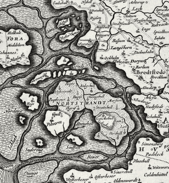
One casualty was the town of Rungholt, which used to yield medieval artefacts and debris into the nets of fishermen until the beginning of the 20th century. Surveys conducted in the 20s and 30s, when remains of the city were suddenly exposed, suggest a large population of about 1500 – 2000 persons. Rungholt was likely a significant port shipping cattle to the markets in Holland and Flandern.
There are no contemporary descriptions of Das Grote Mandrenke, and later estimates of the number of deaths were probably highly exaggerated. However, there is no doubt that its memory lingered for a long time. The local myth still states that whenever a storm brews in the Wadden Sea and the region is threatened with a flood, people sailing through might hear the bells ringing.
All Saints – and November Storms
In the Middle Ages, November used to be the major month for devastating storms; (according to the Gregorian Calendar, these November storms fell closer to December).
Thus in 1436, the first flood of “All Saints” hit the coast, which caused the Cathedral of Schleswig to apply for help in Basel, presenting their plea to the Concilium Brasiliense. The argument was that 60 parishes had been lost to the sea. Once again, in 1532, the second “Storm of All Saints” hit with a vengeance. Several thousand people perished. In the city of Tønder in Southern Jutland, where water stood 5,3 meters above the mean sea level, it reached 1,8 meters up from the floor in the aisle of the church of St. Laurentius.
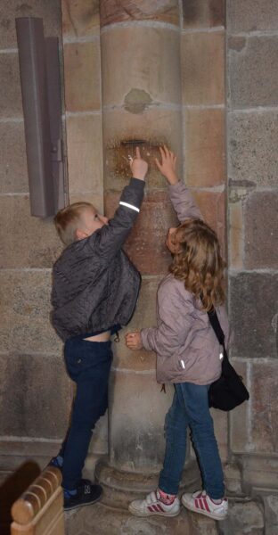
In Ribe, a nearby city, it was possible to catch fish in the cloister of the Cathedral. But, according to a mark posted on the wall in this Cathedral of Ribe, the worst was still to come. In December 1634, the sea reached 5.5 meters above the usual level, and water stood 1,6 meters above the floor in the Cathedral. A chronicler, Peter Sax, wrote that “at seven o’clock the Lord turned the wind into South West and let it storm so fiercely, that no human being could walk nor stand. Between 8 and 9, all dykes were broken and eroded. The air was full of fire, the heaven burned, and the Lord let all thunder, hailstorms and lightening loose while the wind blew with such a strength that the earth moved.” As the result of this storm, the island of Strand was once more broken into fragments, out of which were created the islets of Pellworm, Nordstrand and Nordstrandischmoor. Two-thirds of the population on Strand died during that storm.
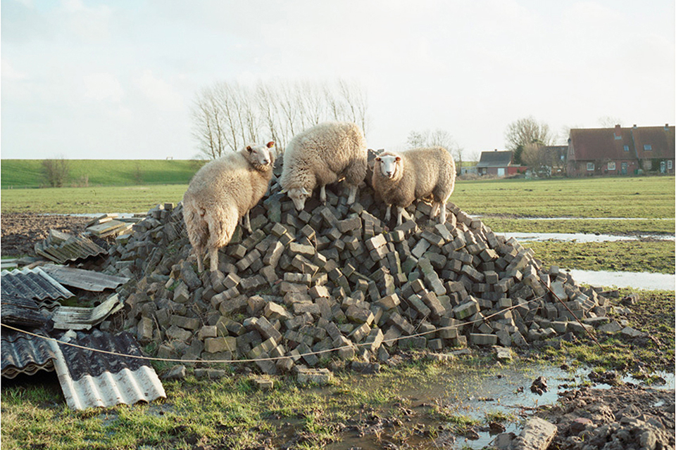
Houses on Terps or Warfts
Early on, people tried to defend themselves against such tidal storms by building their farms or villages on warfts or highly silted banks – artificial mounds.
Thus, the salt marshes of Ditmarschen were already settled during the 1st century AD. Here, archaeological excavations have revealed the existence of such warfts with longhouses bordering a channel at Süderbusenwurth. Larger warts existed along the estuary of the River Eider.
The economy of these settlements was primarily based on cattle grazing in the salt marshes. Only small-scale farming has been demonstrated with plants like horse beans, barley, oats, emmer and flax. The crops were grown in garden plots on higher banks during summer. At some point between AD 400-600, these settlements were abandoned; perhaps the inhabitants took part in the Anglo-Saxon migration to England in this period, or they joined up with the other German-speaking neighbours on their way towards the South (the Langobardians, e.g.)
One explanation for this abandonment was the deteriorating climate after the Roman Optimum, which was incurred after AD 250-400. However, the cutting of turf (peat) in connection with saline production in the marshes throughout Flanders and Southern and Northern Frisia is believed to have contributed to the devastation of the coastline.
Later the area was once more inhabited. The best example of an early medieval warft has been excavated at Wellinghusen near Wöhrden. Here, a settlement was established at the end of the seventh century. Later at the beginning of the ninth century, new housing was erected on separate mounds. Later, a larger village mound was constructed, which was continuously raised until the fourteenth century.
Even today, the inhabitants of several small islands in the North Sea, the Halligen, still depend on such warfts to carry them through stormy weather. Here, the marshes’ traditional way of life may still be experienced.
Dikes and Drainage
In the eleventh century, the building of dikes and the drainage of land began. Initially, dikes were built around the arable fields to keep out the occasional spring or summer floods. The winter floods were heavier but also left precious silt, which fertilised the fields, promising the large yields known from a later period. Hence, they were not so feared.
Later, in the thirteenth century, some of these ring-dikes were connected and raised by cooperatives, called Geschlechter (literally “kinships”) in Ditmarschen. However, such dikes were a blessing in disguise. As the foreland with its tidal flats was reduced, winter flooding became heavier, demanding yet higher dykes to be built. At the same time, the peat was once more systematically cut off and used in salt production, reducing the natural defence mechanisms of the landscape.
It has been argued that this overexploitation, as much as the changing climate, caused the damning effects of the terrible storms during LALIA (AD 536-650) as well as during LIA, The Little Ice Age (AD 1400-1800)
SOURCE:
Medieval Histories, 2012: 11:1
READ MORE
Schleswig-Holstein im Frühen Mittelalter. Landschaft, Archäologie, Geschichte. By Dirk Meier Boyens Verlag 2011 ISBN: 978-3-8042-1341-8
Dike Building, Storm Surges and Land Losses at the North-Sea coast of Schleswig-Holstein, Germany By Dirk Meier www.kuestenarchaeologie.de (For anyone reading German this is a treasure throve of articles and papers about the early medieval life-world in the Wadden Sea.)